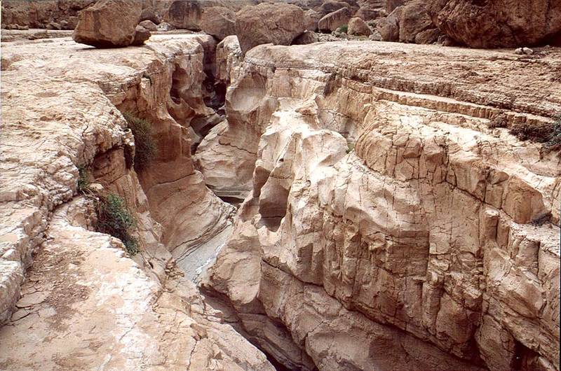
Geye Bahak Gorge, 2 miles north from Masada. The Middle East

🎞️ #171-11
▦ Current Album
Tseelim - Beer-Sheva, January 20 - 26, 2001

Album 171: Tseelim - Beer-Sheva, January 20 - 26, 2001

The image depicts a rugged and rocky landscape, with a prominent gorge or ravine running through it. The terrain is characterized by large boulders and outcroppings of rock, which are weathered and worn down to reveal layers of sedimentary rock.

**Key Features:**

* **Gorge:** A deep, narrow chasm that cuts through the landscape, likely formed by erosion over millions of years.
* **Rocky Terrain:** The dominant feature of the image, with large boulders and outcroppings of rock scattered throughout the area.
* **Sedimentary Rock:** Visible layers of sedimentary rock are exposed in some areas, indicating that this region has been shaped by geological processes over a long period.
* **Weathering:** The rocks appear to be weathered and worn down, suggesting that they have been subject to erosion from wind, water, or ice.

**Geological Context:**

The image appears to be set in the Middle East, near the site of Masada. This region is known for its rich geological history, with many layers of sedimentary rock exposed in the surrounding area.

* **Masada:** A historic fortress built by King Herod the Great, located on a plateau overlooking the Dead Sea.
* **Geological History:** The region has been shaped by millions of years of tectonic activity, erosion, and deposition. – AI vision

Similar Find pictures that are similar to this picture

Thumbnail of picture 171-18: Geye Bahak Gorge, 2 miles north from Masada. The Middle East, January 20, 2001 Similar(1): Geye Bahak Gorge, 2 miles north from Masada. The Middle East, January 20, 2001 Thumbnail of picture 171-13: Picnic at Geye Bahak Gorge, 2 miles north from Masada. The Middle East, January 20, 2001 Similar(2): Picnic at Geye Bahak Gorge, 2 miles north from Masada. The Middle East, January 20, 2001 Thumbnail of picture 171-12: Picnic at Geye Bahak Gorge, 2 miles north from Masada. The Middle East, January 20, 2001 Similar(3): Picnic at Geye Bahak Gorge, 2 miles north from Masada. The Middle East, January 20, 2001 Thumbnail of picture 171-16: A creek on north side of Geye Bahak Gorge, 2 miles north from Masada. The Middle East, January 20, 2001 Similar(4): A creek on north side of Geye Bahak Gorge, 2 miles north from Masada. The Middle East, January 20, 2001 Thumbnail of picture 170-31: Entrance to Nahal Tseelim River Gorge, 2 miles north from Masada. The Middle East, January 20, 2001 Similar(5): Entrance to Nahal Tseelim River Gorge, 2 miles north from Masada. The Middle East, January 20, 2001 Thumbnail of picture 208-22: Flat open area of Tseelim Canyon (Gei Bahak) 3 miles north from Masada. The Middle East, May 17, 2001 Similar(6): Flat open area of Tseelim Canyon (Gei Bahak) 3 miles north from Masada. The Middle East, May 17, 2001 Thumbnail of picture 208-04: Pools of water on a flat area of Tseelim Canyon (Gei Bahak) 3 miles north from Masada. The Middle East, May 17, 2001 Similar(7): Pools of water on a flat area of Tseelim Canyon (Gei Bahak) 3 miles north from Masada. The Middle East, May 17, 2001 Thumbnail of picture 170-30: A.S. at entrance to Nahal Tseelim River Gorge from Dead Sea, 2 miles ... a parking place. The Middle East, January 20, 2001 Similar(8): A.S. at entrance to Nahal Tseelim River Gorge from Dead Sea, 2 miles ... a parking place. The Middle East, January 20, 2001

Keywords & Related