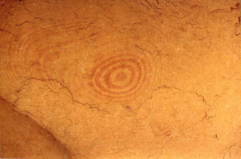
Fresnel-shaped patterns on yellow limestone at the bottom of small caves of Nahal Darokh river 4.5 miles east from Sde Boker. The Middle East

🎞️ #198-20
▦ Current Album
East from Sde Boker, April 9, 2001

Album 198: East from Sde Boker, April 9, 2001

The provided image depicts a close-up view of an ancient petroglyph or rock carving on yellow limestone at the bottom of small caves situated along the Nahal Darokh river. This location is approximately 4.5 miles east from Sde Boker.

**Key Features:**

* **Rock Carving:** The fresnel-shaped patterns appear as concentric circles, reminiscent of a target with an outer ring and inner circle. The pattern suggests movement or energy emanating from the central point.
* **Coloration:** Despite appearing yellow in the image, the limestone is likely to be white or light-colored due to its natural composition.
* **Geological Context:** The presence of caves at the bottom of the river indicates that they were formed by water erosion. The limestone's location near a river supports this theory.

**Implications:**

The fresnel-shaped patterns are believed to be a depiction of ancient knowledge, possibly related to astronomy or ceremonial practices. Their age remains unverified but is estimated based on their likely date of creation and the fact that they have survived for thousands of years without significant deterioration.

**Conclusion:**

This image provides valuable insight into the culture and traditions of an ancient civilization, with the fresnel-shaped patterns serving as a testament to their knowledge and understanding of the natural world. – AI vision

Similar Find pictures that are similar to this picture

Thumbnail of picture 199-01: Horseshoe formation (a round tilted pit 200 - 250 m in diameter and 30 ... from Sde Boker. The Middle East, April 9, 2001 Similar(1): Horseshoe formation (a round tilted pit 200 - 250 m in diameter and 30 ... from Sde Boker. The Middle East, April 9, 2001 Thumbnail of picture 198-36: Horseshoe formation (a round tilted pit 200 - 250 m in diameter and 30 ... from Sde Boker. The Middle East, April 9, 2001 Similar(2): Horseshoe formation (a round tilted pit 200 - 250 m in diameter and 30 ... from Sde Boker. The Middle East, April 9, 2001 Thumbnail of picture 199-11: Horseshoe formation (a round tilted pit 200 - 250 m in diameter and 30 ... from lower site. The Middle East, April 9, 2001 Similar(3): Horseshoe formation (a round tilted pit 200 - 250 m in diameter and 30 ... from lower site. The Middle East, April 9, 2001 Thumbnail of picture 198-12: Caves at Nahal Darokh river 4.5 miles east from Sde Boker. The Middle East, April 9, 2001 Similar(4): Caves at Nahal Darokh river 4.5 miles east from Sde Boker. The Middle East, April 9, 2001 Thumbnail of picture 198-13: View from caves at Nahal Darokh river 4.5 miles east from Sde Boker. The Middle East, April 9, 2001 Similar(5): View from caves at Nahal Darokh river 4.5 miles east from Sde Boker. The Middle East, April 9, 2001 Thumbnail of picture 198-29: Caves with traces of a dried spring on the left, at Nahal Darokh river ... from Sde Boker. The Middle East, April 9, 2001 Similar(6): Caves with traces of a dried spring on the left, at Nahal Darokh river ... from Sde Boker. The Middle East, April 9, 2001 Thumbnail of picture 199-10: Sky seen through caves in the upper side of the horseshoe formation of ... from Sde Boker. The Middle East, April 9, 2001 Similar(7): Sky seen through caves in the upper side of the horseshoe formation of ... from Sde Boker. The Middle East, April 9, 2001 Thumbnail of picture 199-08: Caves along the trail on the eastern side of the horseshoe formation ... from Sde Boker. The Middle East, April 9, 2001 Similar(8): Caves along the trail on the eastern side of the horseshoe formation ... from Sde Boker. The Middle East, April 9, 2001

Keywords & Related