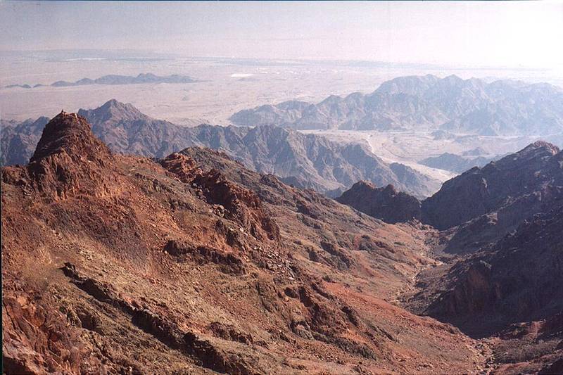
Mapalim creek to the north from Mount Shelomo, 2.5 miles north-west from Eilat. The Middle East

🎞️ #234-31
▦ Current Album
Eilat mountains, Nov. 4, 2001

Album 234: Eilat mountains, Nov. 4, 2001

The image depicts a rugged landscape with steep rocky mountains and valleys. It is taken on November 4, 2001, in the Middle East, specifically near Mount Shelomo and Mapalim creek to the north.

* **Mountains:**
* The mountains are rugged and steep.
* They have jagged peaks and sharp ridges.
* The mountains appear to be composed of rock or stone.
* There is a significant amount of erosion visible on the mountain faces.
* **Valleys:**
* Valleys are located between the mountains, often with steeper sides than the tops of the mountains themselves.
* These valleys appear dry and barren, possibly devoid of vegetation.
* The valleys seem to have been carved out by water erosion over time.
* **Desert Landscape:**
* Beyond the mountains lies a vast desert landscape that stretches into the distance.
* The desert is characterized by its arid conditions, with little or no vegetation visible.
* In the far distance, other mountain ranges may be visible on the horizon.

The image presents a stark and barren landscape, dominated by the rugged mountains and valleys. The absence of vegetation and the presence of erosion suggest that this region has been shaped primarily by geological forces over an extended period. – AI vision

Similar Find pictures that are similar to this picture

Thumbnail of picture 193-11: Upper Nahal Mapalim creek north from Mount Shelomo, 3 miles north-west from Eilat. The Middle East, March 22, 2001 Similar(1): Upper Nahal Mapalim creek north from Mount Shelomo, 3 miles north-west from Eilat. The Middle East, March 22, 2001 Thumbnail of picture 193-10: Start of Nahal Mapalim creek with a trail going north from Mount ... west from Eilat. The Middle East, March 22, 2001 Similar(2): Start of Nahal Mapalim creek with a trail going north from Mount ... west from Eilat. The Middle East, March 22, 2001 Thumbnail of picture 241-03: An acacia tree where Mapalim Creek joins Netafim Creek, at the head of ... from Eilat. The Middle East, December 13, 2001 Similar(3): An acacia tree where Mapalim Creek joins Netafim Creek, at the head of ... from Eilat. The Middle East, December 13, 2001 Thumbnail of picture 234-01: Morning view to south-east from Mount Yehoram, 3.5 miles north-west ... the background. The Middle East, November 4, 2001 Similar(4): Morning view to south-east from Mount Yehoram, 3.5 miles north-west ... the background. The Middle East, November 4, 2001 Thumbnail of picture 234-33: Slopes of Mount Shelomo, 2.5 miles north-west from Eilat. The Middle East, November 4, 2001 Similar(5): Slopes of Mount Shelomo, 2.5 miles north-west from Eilat. The Middle East, November 4, 2001 Thumbnail of picture 234-18: A hill north from Mount Shelomo, 3 miles north-west from Eilat. The Middle East, November 4, 2001 Similar(6): A hill north from Mount Shelomo, 3 miles north-west from Eilat. The Middle East, November 4, 2001 Thumbnail of picture 234-16: View to the north from the ridge north from Mount Shelomo, 3 miles north-west from Eilat. The Middle East, November 4, 2001 Similar(7): View to the north from the ridge north from Mount Shelomo, 3 miles north-west from Eilat. The Middle East, November 4, 2001 Thumbnail of picture 234-24: A ridge 0.5 miles north from Mount Shelomo, 3 miles north-west from Eilat. The Middle East, November 4, 2001 Similar(8): A ridge 0.5 miles north from Mount Shelomo, 3 miles north-west from Eilat. The Middle East, November 4, 2001

Keywords & Related