
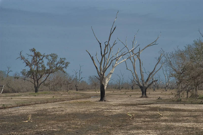

A marsh and dried forest in spoiled area north from Verret, view from Rd. 46 in St.Bernard Parish, east from New Orleans. Louisiana


Album 492: Lower Ninth Ward, Saint Bernard, Esplanade Avenue, New Orleans LA, January 28, 2006
The image shows a marshy, dry forest with dead trees. The foreground is dominated by brown grasses and small plants that have adapted to growing in low-lying areas where water flows through them. There are several dead trees in different stages of decay, some with branches intact and others more bare.
In the background, there appears to be a forest or woodland, although it is not clear if this area is also affected by flooding. The sky above is grayish-blue, indicating that it may have been raining recently.
The overall scene suggests that the area has been damaged by flooding and is now in a state of recovery. The presence of dead trees and the dominance of grasses and small plants indicate that the soil may be nutrient-poor or lacking in organic matter, which could make it difficult for new vegetation to grow.
It's worth noting that the image appears to have been taken after Hurricane Katrina, which caused widespread flooding in New Orleans and surrounding areas. The fact that the image was captured on January 28, 2006, suggests that the area may still be recovering from the storm at this point. – AI vision
🇫🇷 Description en français / French Description
Une marais et forêt desséchée dans la zone polluée au nord de Verret, vue depuis la route 46 dans la paroisse Saint-Bernard, à l'est de La Nouvelle-Orléans. Louisiane, le 28 janvier 2006. L'image montre une forêt marécageuse et sèche avec des arbres morts. Le premier plan est dominé par des herbes brunes et de petites plantes qui se sont adaptées à la croissance dans les zones basses où l'eau coule à travers elles. Il y a plusieurs arbres morts à différents stades de décomposition, certains avec leurs branches intactes et d'autres plus nus. À l'arrière-plan, il semble y avoir une forêt ou un bois, mais il est difficile de dire si cette zone est également affectée par les inondations. Le ciel au-dessus est bleu grisâtre, ce qui indique qu'il a probablement plu récemment. La scène suggère que la zone a été endommagée par les inondations et est en voie de rétablissement. La présence d'arbres morts et la dominance des herbes et des petites plantes indiquent que le sol peut être pauvre en nutriments ou dépourvu de matières organiques, ce qui pourrait rendre difficile la croissance de nouvelles végétations. Il est à noter que l'image a été prise après l'ouragan Katrina, qui a causé d'importantes inondations dans La Nouvelle-Orléans et ses environs. Le fait que l'image ait été capturée le 28 janvier 2006 suggère que la zone se remettait encore de la tempête à ce moment-là. – French translation


