
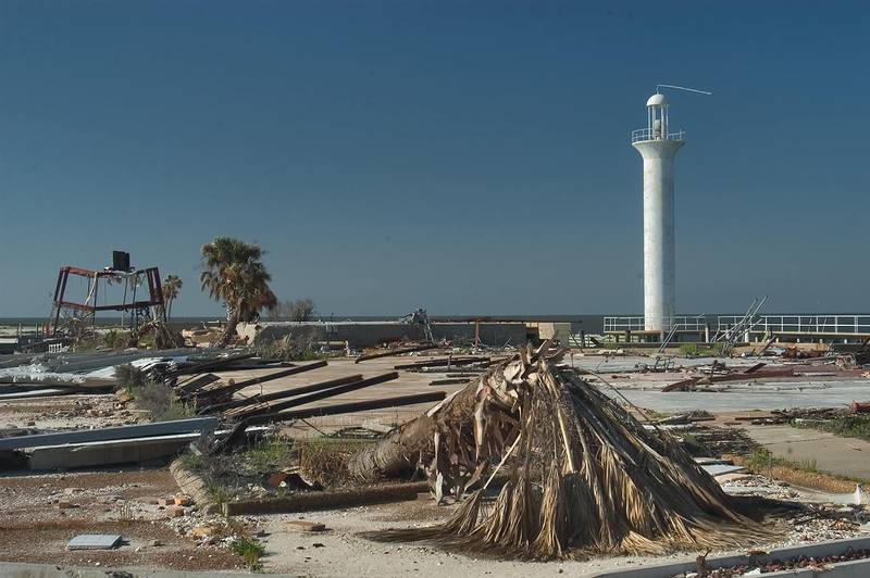

Flattened coastal park near Gulfport. Mississippi


Album 514: Grand Isle LA - Mississippi Coast, April 2 - 9, 2006
The image depicts a devastated coastal area following a hurricane that hit Gulfport, Mississippi, on April 9th of an unspecified year (most likely 2005). The photograph is divided into two sections by a horizontal line running through its center.
In the upper section, the background features a deep blue sky. In the foreground, the remnants of what appears to be a coastal park are visible. Palm trees have been uprooted and lie on their sides in the sand. A few wooden beams from the park's structures can also be seen scattered about.
The lower section of the image shows a white lighthouse situated on the beach. The lighthouse is surrounded by debris, including what appears to be palm fronds.
Given that this photograph was taken after Hurricane Katrina made landfall in 2005, it is likely that the storm left behind significant damage and destruction along the coast. – AI vision
🇪🇸 Descripción en español / Spanish Description
Parque costero aplanado cerca de Gulfport. Mississippi, 9 de abril de 2006. La imagen representa una zona costera devastada después de un huracán que golpeó Gulfport, Misisipi, el 9 de abril de un año no especificado (probablemente 2005). La fotografía se divide en dos secciones por una línea horizontal que atraviesa su centro. En la sección superior, el fondo presenta un cielo azul oscuro. En primer plano, son visibles los restos de lo que parece ser un parque costero. Los árboles de palmeras han sido arrancados y quedan sobre el lado en la arena. También se pueden ver algunas vigas de madera dispersadas por ahí. La parte inferior de la imagen muestra un faro blanco situado en la playa. El faro está rodeado por escombros, incluidos lo que parecen ser hojas de palmera. Dado que esta fotografía fue tomada después del Huracán Katrina cuando tocó tierra en 2005, es probable que la tormenta dejara daños y destrucción significativos a lo largo de la costa. – Spanish translation


