 |
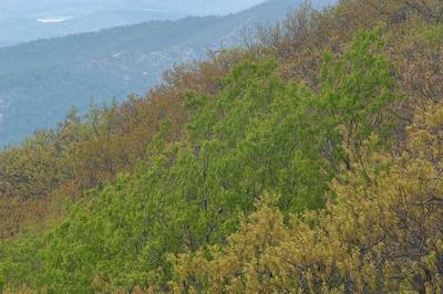
585-21. View from Blue Ridge Parkway near Peaks of Otter. Virginia, May 17, 2007Similar picturesLarge thumbnails | Use small thumbnails | View as slideshow |
|
585-21. View from Blue Ridge Parkway near Peaks of Otter. Virginia, May 17, 2007Similar picturesLarge thumbnails | Use small thumbnails | View as slideshow |
 A waterfall near Blue Ridge Parkway, near Mile 80. Peaks of Otter, Virginia, May 17, 2007  A trillium flower near Blue Ridge Parkway, at Mile 79. Peaks of Otter, Virginia, May 17, 2007  A bush in bloom near Blue Ridge Parkway, near Mile 80. Peaks of Otter, Virginia, May 17, 2007  Otter Creek Overlook near mile 38 of Blue Ridge Parkway. Buena Vista, Virginia, May 17, 2007  A dam of Otter Creek Overlook near mile 38 of Blue Ridge Parkway. Buena Vista, Virginia, May 17, 2007  A waterfall near Old Lodging Railroad at Upper Otter Creek Overlook at mile 35 of Blue Ridge Parkway. Buena Vista, Virginia, May 17, 2007  Falls near Old Lodging Railroad at Upper Otter Creek Overlook at mile 35 of Blue Ridge Parkway. Buena Vista, Virginia, May 17, 2007  View at mile 25 from Blue Ridge Parkway near Spy Run Gap. Waynesboro, Virginia, May 17, 2007  View from Hogback Overlook of Blue Ridge Parkway. Luray, Virginia, May 16, 2007  View at mile 32 of Blue Ridge Parkway. Buena Vista, Virginia, May 17, 2007  View from Hogwallow Flats Overlook of Blue Ridge Parkway. Front Royal, Virginia, May 16, 2007  A pasture at mile 25 of Blue Ridge Parkway near Spy Run Gap. Waynesboro, Virginia, May 17, 2007  A farm at mile 25 near Blue Ridge Parkway near Spy Run Gap. Waynesboro, Virginia, May 17, 2007  Fields at mile 32 near Blue Ridge Parkway. Buena Vista, Virginia, May 17, 2007  Trees from Hogback Overlook of Blue Ridge Parkway. Luray, Virginia, May 16, 2007  Farms from Pine Tree Overlook, at Blue Ridge Parkway. Roanoke, Virginia, May 17, 2007  Valley of Smokey Creek, view to the east from a trail north from Mule Ear Peaks. Big Bend National Park, Texas, November 25, 2007  View from Skyline Drive in fog in the area of Dundo Group Camp. Virginia, May 16, 2007  View from Thorofare Mountain Overlook of Skyline Drive. Skyland, Virginia, May 16, 2007  Hazy hills from Range View Overlook of Skyline Drive. Luray, Virginia, May 16, 2007  An otter in Trailside Museum in Blue Hills Reservation. Boston, Massachusetts, November 6, 2004  Mule Ear Peaks from Smokey Creek Trail. Big Bend National Park, Texas, November 25, 2007  Smokey Creek Trail north from Mule Ear Peaks. Big Bend National Park, Texas, November 25, 2007  Ocotillo on Smokey Creek Trail north from Mule Ear Peaks. Big Bend National Park, Texas, November 25, 2007  Skyline Drive in fog in the area of Loft Mountain. Virginia, May 16, 2007  A stream of Whiteoak Canyon near Skyline Drive. Skyland, Virginia, May 16, 2007  A stone from Thorofare Mountain Overlook of Skyline Drive. Skyland, Virginia, May 16, 2007  A creek near Whiteoak Canyon Trail near Skyline Drive. Skyland, Virginia, May 16, 2007  A road in fog Skyline Drive in the area of Dundo Group Camp. Harrisonburg, Virginia, May 16, 2007  Mule Ear Peaks east from Smokey Creek Trail east from Mule Ear Overlook. Big Bend National Park, Texas, November 25, 2007  Lianes of muscate grape at Southwest Parkway, view from Bee Creek Park. College Station, Texas, August 5, 2022  Virginia Field Park, with gazebo-style octogonal two-tiered bandstand (1895, Karen Renee Wiese Memorial Pavilion) in the center. Calvert, Texas, May 28, 2007  Saalfelden and snowy mountain peaks in the Steinernes Meer with a distinct summit pyramid of Schonfeldspitze (2,653 m) in the Berchtesgaden Alps in Austria and Germany, view from a window of a plane from Houston to Doha. January 16, 2012  Aerial view of the Schweizerland Alps in East Greenland, likely near the Sermilik Fjord region. The jagged, snow-covered peaks visible in the foreground are part of the Schweizerland mountain range (also known as the Schweizerland Alps). This is one of the highest and most alpine regions in Greenland, located just west of the town of Tasiilaq. The image shows deep valleys filled with snow and ice, with massive glaciers flowing down from the high peaks towards the fjords. The interplay of sharp ridges (are^tes) and ice-filled basins (cirques) creates a classic, high-alpine landscape that rivals the European Alps in ruggedness but on a much wilder scale. The large body of water visible in the background (center-right) is likely Sermilik Fjord, a major fjord known for being choked with icebergs calved from the Helheim and other glaciers. The water reflects the sunlight, creating a bright contrast against the darker mountains. View from a window of an airplane from Helsinki to Dallas, Greenland, October 17, 2025  Gazebo-style octogonal two-tiered bandstand (1895) (Karen Renee Wiese Memorial Pavilion) in the center of Virginia Field Park. Calvert, Texas, January 28, 2007  Houghtons Pond, view from an observatory on the top of Great Blue Hill in Blue Hills Reservation. Boston, Massachusetts, November 6, 2004  View along a ridge from Mount Keylagkuh in south-western Iran. View from a window of a plane from Doha, Qatar to Houston, TX, March 16, 2010.  Appalachian Trail on a ridge of Kittatinny Mountains. Delaware Water Gap, New Jersey, May 12, 2007  Village of Hangam, view along a ridge from Mount Keylagkuh in south-western Iran. View from a window of a plane from Doha, Qatar to Houston, TX, March 16, 2010.  Forest on Ridge Trail near Trailpoint 13 in Sourland Mountain Preserve. Somerset County, New Jersey, May 6, 2007  Dogwood in a forest on Ridge Trail east Trailpoint 13 in Sourland Mountain Preserve. Somerset County, New Jersey, May 6, 2007  A deer on Linear Park Trail (former railroad) in Cook Natural Area, near Ridge Road. Kingston, New Jersey, May 11, 2007  A small flower on Mount Rose Ridge Trail in Stony Brook Watershed park. Pennington, New Jersey, April 29, 2007  Blue pimpernel flowers in a riverbed of a tributary of Nahal Revivim descending from a mountain ridge near Yeroham reservoir. The Middle East, March 8, 2001  Showy Orchis (Galearis spectabilis) orchid wildflower on Ridge Trail above Trailpoint 1 in Sourland Mountain Preserve. Somerset County, New Jersey, May 6, 2007  Garlic mustard and cut leaf toothwort in background on Mount Rose Ridge Trail in Stony Brook Watershed park. Pennington, New Jersey, April 29, 2007  Blue Parlor of Yusupov Palace. Saint Petersburg, Russia, September 6, 2007  Camping on a small ridge near Juniper Canyon Trail south from Upper Juniper Spring. Big Bend National Park, Texas, November 22, 2007  May apple leaf growing through a dry leaf on Mount Rose Ridge Trail in Stony Brook Watershed park. Pennington, New Jersey, April 29, 2007  Blue Trail in Six Mile Run Reservoir, approaching Blackwell Mills Road. Somerset, New Jersey, April 29, 2007  Prickly pears cactus on a small ridge near Juniper Canyon Trail south from Upper Juniper Spring. Big Bend National Park, Texas, November 22, 2007  Old railroad bridge of MKT Parkway. Columbia, Missouri, September 8, 2005  Lost Falls near Blue Trail in DeSoto State Park on Lookout Mountain. Fort Payne, Alabama, May 19, 2007  View of a mountain ridge behind Yeroham reservoir. The Middle East, March 8, 2001  View from a mountain ridge behind Yeroham reservoir. The Middle East, March 8, 2001  View of desert from rocky ridge of Jebel Fuwairit. Qatar, January 31, 2015  View of hills near Yeroham from a trail from a damn to the mountain ridge. The Middle East, March 8, 2001  View of a heavily polluted Yeroham reservoir from a mountain ridge. The Middle East, March 8, 2001  Deeper inland over the East Greenland coast, likely near the major glacial systems feeding into the Sermilik Fjord complex. The massive, heavily crevassed glacier visible in the lower center (flowing from left to right) is characteristic of the major outlet glaciers in this region, such as Helheim Glacier or Midgard Glacier. These are some of the largest and fastest-flowing glaciers in Greenland, draining huge volumes of ice from the interior ice sheet into the fjords.:200b The intensely wrinkled texture of the glacier surface is caused by deep crevasses (cracks) that form as the ice flows over uneven bedrock and bends around mountains. The chaotic, shattered appearance indicates rapid movement and significant stress within the ice. The dark, jagged peaks rising above the ice are part of the coastal mountain ranges (likely the Schweizerland Alps mentioned previously). In this view, you can see how the ice sheet wraps around and flows between these mountains, essentially burying the valleys in ice. In the bottom right corner, a turquoise-colored lake is visible. This is a proglacial lake, formed by meltwater trapped between the glacier and the mountains. The distinctive color comes from "glacial flour" (fine rock particles) suspended in the water. This transition from the rugged coastal peaks (in the previous image) to the massive, flowing rivers of ice marks the boundary between the coastal mountains and the vast Greenland Ice Sheet proper. It is the dynamic edge where the ice sheet discharges into the ocean, a critical zone for understanding global sea-level rise. View from a window of an airplane from Helsinki to Dallas, Greenland, October 17, 2025  View from a rocky ridge in Jabal Al Jassasiya site, on north-eastern coast. Qatar, December 26, 2015  Mountain ridge in southern Iran, near Kerman. View from a window of a plane from Dubai, UAE to Houston, TX, April 28, 2011  View from a rocky ridge in Jabal Al Jassasiya site, on north-eastern coast. Qatar, December 12, 2015  Echinocactus horizonthalonius (devil s head cactus, or horse crippler) with daggerlike spines on a small ridge near Juniper Canyon Trail south from Upper Juniper Spring. Big Bend National Park, Texas, November 22, 2007  View from a ridge along Gishron cliffs (trail 20564) 3 miles west from Eilat. The Middle East, January 17, 2002  View to the east from a rocky ridge in Jabal Al Jassasiya site, on north-eastern coast. Qatar, December 26, 2015  Mountain laurel flowers on Blue Trail in DeSoto State Park on Lookout Mountain. Fort Payne, Alabama, May 19, 2007  View of a northern slope of Nahal Oren river from Etzba Ridge on Mount Carmel. The Middle East, March 5, 2002  Bolete mushrooms Hortiboletus campestris(?) under a live oak on a lawn on James Parkway. College Station, Texas, November 15, 2017  Mountain ridge of Kuhe Derbend in Iran, north-east of Ravar. View from a window of a plane from Dubai, UAE to Houston, TX, April 28, 2011  River cutting a mountain ridge of Kuhe Sangi in Iran, east of Ravar. View from a window of a plane from Dubai, UAE to Houston, TX, April 28, 2011  Typical hills near Yeroham, view from a mountain ridge behind Yeroham reservoir. The Middle East, March 8, 2001  View of hills near Yeroham from the highest point of a mountain ridge behind Yeroham reservoir. The Middle East, March 8, 2001  Kuhe-Meimend Ridge and Rudhaneye-Hane-Begom River in south-western Iran. View from a window of a plane from Doha, Qatar to Houston, TX, March 16, 2010.  Kuhe-Asi Ridge and Rudhaneye-Hane-Begom River to the left, in south-western Iran. View from a window of a plane from Doha, Qatar to Houston, TX, March 16, 2010.  Blue violets on Stony Brook trail in Stony Brook - Millstone Watershed Main Reserve. Pennington, New Jersey, April 28, 2007  View to the west from Rattlesnake Mountain. Delaware Water Gap, New Jersey, May 12, 2007  View of Manhattan from High Mountain. Paterson, New Jersey, March 25, 2007  Sorghum ergot fungus (Claviceps africana) on flowers of johnsongrass taken from Bee Creek Park, south from Southwest Parkway bridge. College Station, Texas, August 27, 2020  A view from Clingmans Dome. Smoky Mountains National Park, Tennessee, May 18, 2007  A view from Newfound Gap Road. Smoky Mountains National Park, Tennessee, May 18, 2007  Road junction south from Chicago, view from a plane. Illinois, August 7, 2007  View to the west from observatory of Hancock Tower. Chicago, Illinois, September 11, 2007  People on a street, view from a window of a tourist bus. Novgorod, Russia, August 11, 2007  People near a bus stop, view from a window of a tourist bus. Novgorod, Russia, August 11, 2007  View of Manhattan from North Beach. Sandy Hook, New Jersey, March 11, 2007  Walpack Valley, view from Mountain Road. Delaware Water Gap, New Jersey, May 12, 2007  Givat Rehavam hill cone made of chalk and marl, view from a ridge along Gishron cliffs (trail 20564) 3 miles west from Eilat. The Middle East, October 17, 2002  Givat Rehavam hill cone made of chalk and marl, view from a ridge along Gishron cliffs (trail 20564) 3 miles west from Eilat. The Middle East, January 17, 2002  Givat Rehavam hill cone made of chalk and marl, view from a ridge along Gishron cliffs (trail 20564) 3 miles west from Eilat. The Middle East, October 17, 2002 |


