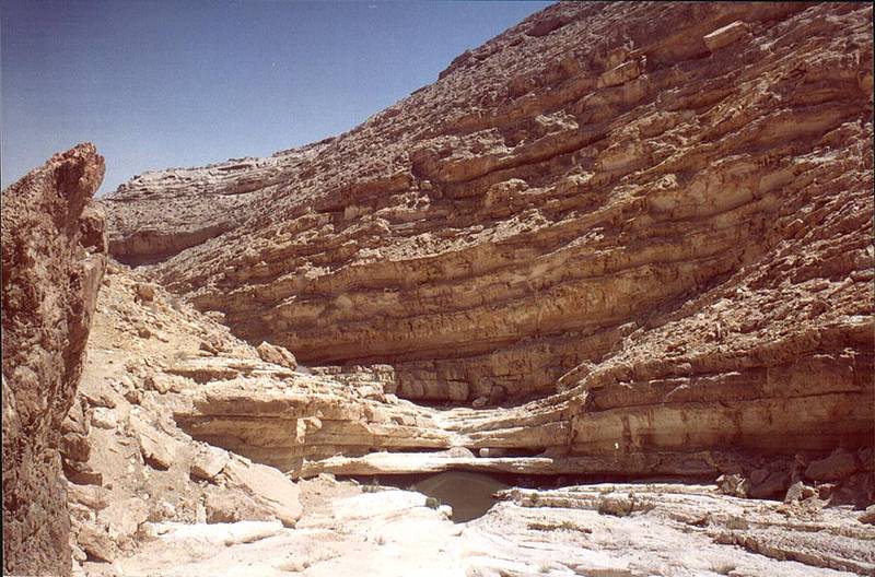
View of a big pool behind the second fall of Nahal Darokh river 4 miles east from Sde Boker. The Middle East

🎞️ #198-35
▦ Current Album
East from Sde Boker, April 9, 2001

Album 198: East from Sde Boker, April 9, 2001

The image presents a striking view of a natural pool situated at the base of a rugged rocky formation, with a clear blue sky visible above.

**Key Features:**

* **Pool:** The pool is surrounded by large boulders and rocks, creating a sense of seclusion. Its calm surface reflects the surrounding landscape.
* **Rock Formation:** The rocky structure, likely composed of sandstone or limestone, features a series of layers that suggest a geological history spanning millions of years.
* **Environment:** The scene is set in a desert environment, as evidenced by the lack of vegetation and the presence of arid terrain.

**Atmosphere:**

The image exudes a sense of serenity and tranquility, evoking feelings of awe and wonder at the natural beauty of the pool and its surroundings. The clear blue sky adds to the overall atmosphere of calmness and peacefulness.

**Overall Impression:**

The image captures a breathtaking moment in time, inviting the viewer to reflect on the majesty and complexity of nature. – AI vision

Similar Find pictures that are similar to this picture

Thumbnail of picture 198-32: A big pool with mosquito larvae behind the second fall of Nahal Darokh ... from Sde Boker. The Middle East, April 9, 2001 Similar(1): A big pool with mosquito larvae behind the second fall of Nahal Darokh ... from Sde Boker. The Middle East, April 9, 2001 Thumbnail of picture 198-27: Thorny plants near a small pool of Nahal Darokh river 4.5 miles east from Sde Boker. The Middle East, April 9, 2001 Similar(2): Thorny plants near a small pool of Nahal Darokh river 4.5 miles east from Sde Boker. The Middle East, April 9, 2001 Thumbnail of picture 198-13: View from caves at Nahal Darokh river 4.5 miles east from Sde Boker. The Middle East, April 9, 2001 Similar(3): View from caves at Nahal Darokh river 4.5 miles east from Sde Boker. The Middle East, April 9, 2001 Thumbnail of picture 199-16: Tributary of Nahal Darokh river going through chalk hills 4 miles east ... from lower site. The Middle East, April 9, 2001 Similar(4): Tributary of Nahal Darokh river going through chalk hills 4 miles east ... from lower site. The Middle East, April 9, 2001 Thumbnail of picture 198-07: Nahal Darokh river 4.5 miles east from Sde Boker. The Middle East, April 9, 2001 Similar(5): Nahal Darokh river 4.5 miles east from Sde Boker. The Middle East, April 9, 2001 Thumbnail of picture 198-06: Nahal Darokh river 4.5 miles east from Sde Boker. The Middle East, April 9, 2001 Similar(6): Nahal Darokh river 4.5 miles east from Sde Boker. The Middle East, April 9, 2001 Thumbnail of picture 198-12: Caves at Nahal Darokh river 4.5 miles east from Sde Boker. The Middle East, April 9, 2001 Similar(7): Caves at Nahal Darokh river 4.5 miles east from Sde Boker. The Middle East, April 9, 2001 Thumbnail of picture 198-01: Upper Nahal Darokh river 5 miles east from Sde Boker. The Middle East, April 9, 2001 Similar(8): Upper Nahal Darokh river 5 miles east from Sde Boker. The Middle East, April 9, 2001

Keywords & Related