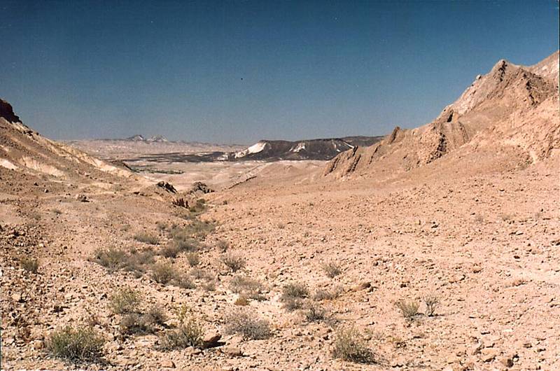
View to the west along southern side of Ramon Crater near Ammonites wall, 6 miles south-east from Mitzpe Ramon. The Middle East

🎞️ #204-19
▦ Current Album
Timna, Beer-Sheva and Ramon Crater, April 25 - May 3, 2001

Album 204: Timna, Beer-Sheva and Ramon Crater, April 25 - May 3, 2001

The image depicts a vast desert landscape with rugged mountains and hills stretching into the distance, under a clear blue sky.

In the foreground, sparse vegetation is visible in the form of small bushes or shrubs growing on a rocky terrain covered with sand. The ground appears dry and barren, devoid of any signs of recent rainfall or moisture.

The mountain range in the background stretches across nearly half of the image's width, sloping gently from left to right before rising steeply into two peaks. The mountains are primarily composed of brown rock, with lighter-colored patches visible on their slopes. A dark streak along the top of the nearer peak may be a shadow or an area devoid of vegetation.

The sky above is clear and cloudless, appearing a deep shade of blue towards the horizon before gradually lightening to pale blue near the top of the image. The overall atmosphere suggests a hot and arid climate, with little rainfall in recent times.

The location is identified as Ramon Crater, situated near Ammonites wall, approximately 6 miles south-east from Mitzpe Ramon in the Middle East. This region is known for its unique geological formations and diverse wildlife. The image provides a glimpse into the natural beauty of this area, highlighting its unique landscape features and harsh desert environment. – AI vision

Similar Find pictures that are similar to this picture

Thumbnail of picture 204-20: View to north-east along southern side of Ramon Crater near Ammonites ... from Mitzpe Ramon. The Middle East, May 3, 2001 Similar(1): View to north-east along southern side of Ramon Crater near Ammonites ... from Mitzpe Ramon. The Middle East, May 3, 2001 Thumbnail of picture 204-16: Southern side of Ramon Crater near Ammonites wall, 6 miles south-east from Mitzpe Ramon. The Middle East, May 3, 2001 Similar(2): Southern side of Ramon Crater near Ammonites wall, 6 miles south-east from Mitzpe Ramon. The Middle East, May 3, 2001 Thumbnail of picture 204-21: Southern side of Ramon Crater near Ammonites wall, 6 miles south-east from Mitzpe Ramon. The Middle East, May 3, 2001 Similar(3): Southern side of Ramon Crater near Ammonites wall, 6 miles south-east from Mitzpe Ramon. The Middle East, May 3, 2001 Thumbnail of picture 205-20: Southern side of Ramon Crater near the road to Eilat, view to the east ... from Mitzpe Ramon. The Middle East, May 3, 2001 Similar(4): Southern side of Ramon Crater near the road to Eilat, view to the east ... from Mitzpe Ramon. The Middle East, May 3, 2001 Thumbnail of picture 204-36: View to the west along Nahal Nekarot River at southern side of Ramon ... from Mitzpe Ramon. The Middle East, May 3, 2001 Similar(5): View to the west along Nahal Nekarot River at southern side of Ramon ... from Mitzpe Ramon. The Middle East, May 3, 2001 Thumbnail of picture 204-34: Approaching Ramon s Tooth (black hill) at southern side of Ramon ... from Mitzpe Ramon. The Middle East, May 3, 2001 Similar(6): Approaching Ramon s Tooth (black hill) at southern side of Ramon ... from Mitzpe Ramon. The Middle East, May 3, 2001 Thumbnail of picture 205-36: A jeep road at the bottom of Ramon Crater approaching Nahal Ramon ... from Mitzpe Ramon. The Middle East, May 3, 2001 Similar(7): A jeep road at the bottom of Ramon Crater approaching Nahal Ramon ... from Mitzpe Ramon. The Middle East, May 3, 2001 Thumbnail of picture 204-32: A big tributary of Nahal Nekarot River and Ramon s Tooth (black hill ... from Mitzpe Ramon. The Middle East, May 3, 2001 Similar(8): A big tributary of Nahal Nekarot River and Ramon s Tooth (black hill ... from Mitzpe Ramon. The Middle East, May 3, 2001

Keywords & Related