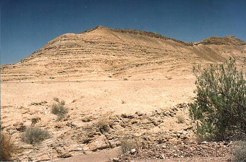
A hill at the bottom of Ramon Crater, view to the east, 3 miles south-east from Mitzpe Ramon. The Middle East

🎞️ #205-35
▦ Current Album
Ramon Crater, May 3, 2001

Album 205: Ramon Crater, May 3, 2001

The image depicts a desert landscape featuring a prominent hill situated at the bottom of Ramon Crater, with a view to the east. This photograph was taken on May 3rd, 2001, approximately three miles south-east from Mitzpe Ramon in the Middle East.

**Key Features**

* The hill is characterized by its layered structure, indicating geological erosion and deposition processes.
* The surrounding terrain appears arid, with sparse vegetation visible.
* The sky above is clear and blue, suggesting a dry climate.

**Geological Context**

The image provides a glimpse into the geological history of the region. The layers on the hill's surface likely represent different periods of sedimentation or erosion, offering insights into the area's tectonic activity and environmental conditions over time.

**Environmental Conditions**

* **Climate:** The clear blue sky suggests that the region experiences low rainfall or is located in a dry climate zone.
* **Vegetation:** Sparse vegetation on the hill and surrounding terrain indicates limited water availability and possibly harsh environmental conditions.

**Conclusion**

The image captures a unique moment in geological time, revealing the complex history of Ramon Crater and its surroundings. The layered structure of the hill and sparse vegetation provide evidence of the region's arid climate and geological processes that have shaped this landscape over millions of years. – AI vision

Similar Find pictures that are similar to this picture

Thumbnail of picture 205-33: A hill at the bottom of Ramon Crater, view to the east, 3.5 miles south-east from Mitzpe Ramon. The Middle East, May 3, 2001 Similar(1): A hill at the bottom of Ramon Crater, view to the east, 3.5 miles south-east from Mitzpe Ramon. The Middle East, May 3, 2001 Thumbnail of picture 205-36: A jeep road at the bottom of Ramon Crater approaching Nahal Ramon ... from Mitzpe Ramon. The Middle East, May 3, 2001 Similar(2): A jeep road at the bottom of Ramon Crater approaching Nahal Ramon ... from Mitzpe Ramon. The Middle East, May 3, 2001 Thumbnail of picture 205-30: A hill at the bottom of Ramon Crater, view to the north, 3.5 miles south-east from Mitzpe Ramon. The Middle East, May 3, 2001 Similar(3): A hill at the bottom of Ramon Crater, view to the north, 3.5 miles south-east from Mitzpe Ramon. The Middle East, May 3, 2001 Thumbnail of picture 205-19: A small hill with a flat summit at the bottom of Ramon Crater to the ... from Mitzpe Ramon. The Middle East, May 3, 2001 Similar(4): A small hill with a flat summit at the bottom of Ramon Crater to the ... from Mitzpe Ramon. The Middle East, May 3, 2001 Thumbnail of picture 205-29: Multicolored sands at the bottom of Ramon Crater, view to the east, 4 ... from Mitzpe Ramon. The Middle East, May 3, 2001 Similar(5): Multicolored sands at the bottom of Ramon Crater, view to the east, 4 ... from Mitzpe Ramon. The Middle East, May 3, 2001 Thumbnail of picture 205-32: View of Ramon s Tooth to the south from the bottom of Ramon Crater, 3 ... from Mitzpe Ramon. The Middle East, May 3, 2001 Similar(6): View of Ramon s Tooth to the south from the bottom of Ramon Crater, 3 ... from Mitzpe Ramon. The Middle East, May 3, 2001 Thumbnail of picture 205-34: View of Ramon s Tooth to the south from the bottom of Ramon Crater, 3 ... from Mitzpe Ramon. The Middle East, May 3, 2001 Similar(7): View of Ramon s Tooth to the south from the bottom of Ramon Crater, 3 ... from Mitzpe Ramon. The Middle East, May 3, 2001 Thumbnail of picture 205-24: Stones on a bottom of a creek along the trail going to Ramon Crater ... from Mitzpe Ramon. The Middle East, May 3, 2001 Similar(8): Stones on a bottom of a creek along the trail going to Ramon Crater ... from Mitzpe Ramon. The Middle East, May 3, 2001

Keywords & Related