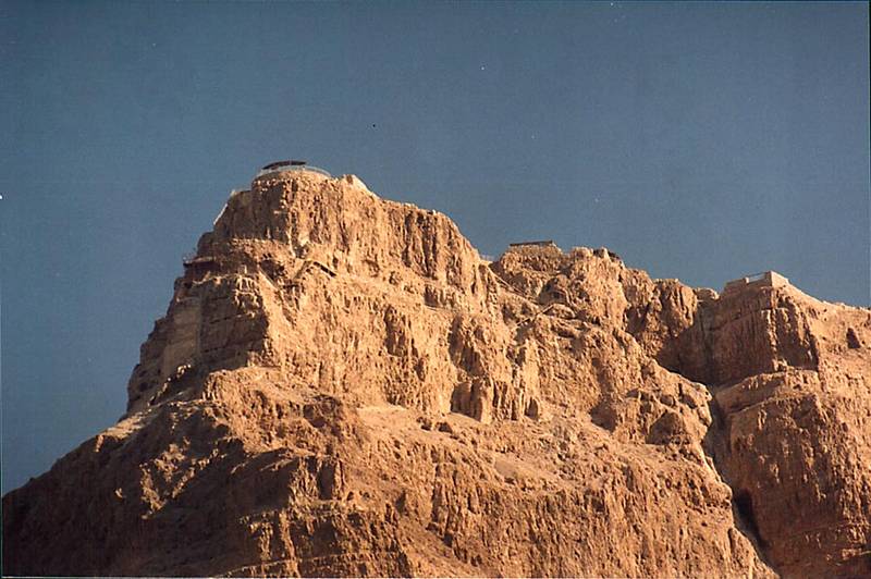
Masada fortress on the top of a hill, view from Roman road 1 mile north from Masada at evening. The Middle East

🎞️ #208-36
▦ Current Album
Nahal Peres near Dead Sea, evening of May 17, 2001

Album 208: Nahal Peres near Dead Sea, evening of May 17, 2001

The image shows a rocky hill with a large structure built into its side.

* **Location and Size**: The structure is located on top of the hill, which appears to be quite tall.
* There are other smaller structures visible on the lower part of the hill.
* **Architecture**: The larger structure has walls that appear to be made of stone or rock, with no sign of any windows or doors.
* A flat roof can be seen at the top of the wall, which may indicate a lookout tower or observation deck.
* The smaller structures below also have similar walls and roofs.
* **Setting**: The hill is surrounded by other hills in the distance, but there are no signs of vegetation on its slopes.
* It appears to be a dry, rocky landscape with little cover from the elements.

Overall, this image suggests that Masada fortress has been built into the side of a hill to provide natural protection against invaders and to command an excellent view of its surroundings. – AI vision

Similar Find pictures that are similar to this picture

Thumbnail of picture 208-33: View of a hill with Masada fortress on the top from the Roman road 1.5 ... Masada at evening. The Middle East, May 17, 2001 Similar(1): View of a hill with Masada fortress on the top from the Roman road 1.5 ... Masada at evening. The Middle East, May 17, 2001 Thumbnail of picture 208-38: Streams and small canyons (Masada Marls) in the direction of Dead Sea ... north from Masada. The Middle East, May 17, 2001 Similar(2): Streams and small canyons (Masada Marls) in the direction of Dead Sea ... north from Masada. The Middle East, May 17, 2001 Thumbnail of picture 208-35: Creeks going through marls (powdery chalk substance) to Dead Sea, view ... north from Masada. The Middle East, May 17, 2001 Similar(3): Creeks going through marls (powdery chalk substance) to Dead Sea, view ... north from Masada. The Middle East, May 17, 2001 Thumbnail of picture 208-34: Desert acacia in bloom along the Roman road 1 mile north from Masada. The Middle East, May 17, 2001 Similar(4): Desert acacia in bloom along the Roman road 1 mile north from Masada. The Middle East, May 17, 2001 Thumbnail of picture 208-31: End of Nahal Tseelim canyon from the Roman road to Masada, 2.5 miles north from Masada. The Middle East, May 17, 2001 Similar(5): End of Nahal Tseelim canyon from the Roman road to Masada, 2.5 miles north from Masada. The Middle East, May 17, 2001 Thumbnail of picture 207-28: Tseelim River, view from Roman road along Dead Sea from Masada. The Middle East, May 17, 2001 Similar(6): Tseelim River, view from Roman road along Dead Sea from Masada. The Middle East, May 17, 2001 Thumbnail of picture 207-32: Northern tributary of Tseelim River, view from Roman road from Masada. The Middle East, May 17, 2001 Similar(7): Northern tributary of Tseelim River, view from Roman road from Masada. The Middle East, May 17, 2001 Thumbnail of picture 208-37: Streams and small canyons carved in soft limestone in the direction of ... north from Masada. The Middle East, May 17, 2001 Similar(8): Streams and small canyons carved in soft limestone in the direction of ... north from Masada. The Middle East, May 17, 2001

Keywords & Related