 |
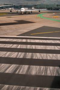
1226-15. Airport roads, view from an airplane departing Frankfurt, Germany, June 30, 2013Similar picturesLarge thumbnails | Use small thumbnails | View as slideshow |
|
1226-15. Airport roads, view from an airplane departing Frankfurt, Germany, June 30, 2013Similar picturesLarge thumbnails | Use small thumbnails | View as slideshow |
 Approaching south-east coast of Greenland near Tingmiarmit Island, view from a window of a plane from Frankfurt, Germany to Toronto, Canada, June 30, 2013  Islands of Bredefjord fjord in Kujalleq region on southern tip of Greenland, view from a window of a plane from Frankfurt, Germany to Toronto, Canada, June 30, 2013  Eqalorutsit Glacier flowing to Gannet Bay in Kujalleq region on southern tip of Greenland, view from a window of a plane from Frankfurt, Germany to Toronto, Canada, June 30, 2013  Napassorssuaq Fjord on east coast in Kujalleq region on southern tip of Greenland, view from a window of a plane from Frankfurt, Germany to Toronto, Canada, June 30, 2013  Drifting ice on south-east approach to coast of Greenland near Mogens Heinesen Fjord, view from a window of a plane from Frankfurt, Germany to Toronto, Canada, June 30, 2013  Islands of Bredefjord fjord north from Simiutag in Kujalleq region on southern tip of Greenland, view from a window of a plane from Frankfurt, Germany to Toronto, Canada, June 30, 2013  Glacier flowing to Tunugduareik Lake north from Narsarsuaq in Kujalleq region on southern tip of Greenland, view from a window of a plane from Frankfurt, Germany to Toronto, Canada, June 30, 2013  Kap Cort Adelaer and Kap Daniel Rantzau on east coast in Kujalleq region on south of Greenland, view from a window of a plane from Frankfurt, Germany to Toronto, Canada, June 30, 2013  Eqalorutsit Glacier flowing to Gannet Bay west from Qagssirssuk in Kujalleq region on southern tip of Greenland, view from a window of a plane from Frankfurt, Germany to Toronto, Canada, June 30, 2013  Qoroq Glacier flowing to Tunugduareik Lake north from Narsarsuaq in Kujalleq region on southern tip of Greenland, view from a window of a plane from Frankfurt, Germany to Toronto, Canada, June 30, 2013  Kap Steen Bille, Kap Cort Adelaer and Kap Daniel Rantzau on east coast in Kujalleq region on south of Greenland, view from a window of a plane from Frankfurt, Germany to Toronto, Canada, June 30, 2013  Mountains east from glacier flowing to Tunugduareik Lake north from Narsarsuaq in Kujalleq region on southern tip of Greenland, view from a window of a plane from Frankfurt, Germany to Toronto, Canada, June 30, 2013  Glacier flowing from Kong Frederik Den Vi Kyst Ice Field to Anoritup Kangerdlua Fjord on east coast in Kujalleq region on southern tip of Greenland, view from a window of a plane from Frankfurt, Germany to Toronto, Canada, June 30, 2013  Intersection of roads 10 and 310 west from Louis Armstrong New Orleans Airport, with a traffic jam in direction to New Orleans, view from a plane. New Orleans, Louisiana, May 17, 2006  Approached United Airlines airplane, view from a window of airplane, near London, May 15, 2014  Indianapolis(?) airport seen from a window of a plane Saint Petersburg - Frankfurt - Chicago - Indianapolis, April 28, 1999.  Perspective view of airport escalators (moving sidewalks, or walkways) in Hamad International Airport. Doha, Qatar, September 17, 2015  This image captures the view from a window of an aircraft taxiing at Dallas-Fort Worth International Airport (DFW), looking out over the wing towards another terminal and active taxiways. JZ -> Z ->" Sign: The yellow and black sign visible on the grass is a taxiway direction sign. It indicates that the aircraft is currently on or approaching taxiway JZ and that taxiway Z ("Zulu") continues to the right. The yellow background with black letters is standard for direction signs, telling pilots where to turn to reach a specific taxiway. While the "Z" symbol has gained political connotations elsewhere, in aviation, it is purely phonetic alphabet usage ("Zulu"). The solid double yellow lines (resembling the St. George Ribbon) mark the edge of the usable taxiway pavement. Based on the "Z" and "JZ" taxiways, this view is likely on the east side of the airport, near Terminal D or the future Terminal F site, looking towards the terminal complex. The flat, sprawling landscape and sunny skies are characteristic of the North Texas region. View from a window of an airplane from Helsinki to Dallas, Texas, October 18, 2025  Airplane landing on American military base Al Udeid, view from dunes area south from Abu Nahlah. Qatar, June 23, 2015  Al Udeid Air Base (Abu Nahlah Airport) near Mesayeed, south-west from Doha, view from a window of a car. Qatar, March 19, 2013  Old Passenger Terminal of Tallinn Airport. Built between 1945 and 1954 (opened in 1955), this building is a classic example of Stalinist architecture. Its symmetrical facade, rusticated ground floor, and the distinctive control tower with a viewing gallery reflect the monumental style favored in the Soviet Union during that period. An earlier Art Deco/Functionalist terminal was designed in 1938 by the architect Arthur Ju"rvetson, but construction was halted by World War II. The post-war redesign incorporated the Soviet aesthetic. This building served as the main passenger terminal until 1980, when a new, larger terminal (the current one) was built for the Moscow Olympics sailing regatta held in Tallinn. Today, this historic building has been repurposed for VIP services and administrative offices. It stands separately from the modern glass-and-steel terminal but remains an integral part of the airport s history, visible to passengers taxiing on the runway. View from a window of an airplane from Tallinn to Helsinki. Estonia, October 17, 2025  This aerial view shows the suburban landscape of Coppell, Texas, where State Highway 121 merges with the Sam Rayburn Tollway, just north-northwest of DFW International Airport. The prominent highway is the confluence of SH 121 and the Sam Rayburn Tollway, a critical artery connecting the northern Dallas suburbs. The complex interchange and heavy traffic are characteristic of the DFW metroplex s extensive highway system. The natural waterway winding through the scene is Denton Creek. The creek and the surrounding ponds create a greenbelt that offers a natural buffer between the highway and residential areas . These water features are integral to the master-planned communities in Coppell, providing both drainage and recreational space. The dense, master-planned neighborhoods with their distinctive gray roofs are typical of Coppell. On the right, the development is part of the Riverchase area, while the homes in the upper left are also part of Coppell s extensive suburban grid. The large white buildings in the lower-left are warehouses and logistics centers, strategically located near DFW Airport and the major highway interchange for easy distribution. View from a window of an airplane from Helsinki to Dallas, Greenland, October 17, 2025  Junk cars, view from Road 50, near Airport Road. Brenham, Texas, June 2, 2007  This aerial view captures the "horseshoe" terminal design characteristic of Dallas-Fort Worth International Airport (DFW), taken just after takeoff. The large, semi-circular terminal in the foreground is Terminal C. This is American Airlines primary domestic hub terminal. The distinctive curved parking garages nestled inside the "U" shape are a signature feature of DFW s original design, minimizing walking distance from car to gate. The extension visible on the left side of the terminal arc is known as the "High C" gates (gates C35-C39). This area was renovated earlier than the rest of the terminal and serves many American Eagle regional flights. In the background (top right), across the highway spine, is Terminal E. One can identify it by the Spirit Airlines aircraft (yellow livery) parked at the gates, as Spirit operates primarily from Terminal E. The elevated guideway running above the terminal roof and connecting the different arms of the horseshoe is the Skylink automated people mover system. This bi-directional train connects all five terminals inside the secure area, allowing passengers to transfer without re-clearing security. The multi-lane highway running through the center of the image (between the terminals) is International Parkway, the main spine road that bisects the airport north-to-south. View from a window of an airplane from Dallas to College Station, Texas, October 18, 2025  Dubai after airplane takeoff, view from a window of a plane. UAE, December 30, 2015  Wind farm in a sea near Great Britain, view from a window of airplane, May 15, 2014  Deira Islands in Dubai after airplane takeoff, view from a window of a plane. UAE, December 30, 2015  Dubai in area of Al Khabaisi after airplane takeoff, view from a window of a plane. UAE, December 30, 2015  Roads north from the Farm (Ferma) in Gatchina, a suburb of Saint Petersburg. Russia, September 21, 2013  Dafna (West Bay) area of Doha from a window of an airplane. Qatar, November 18, 2013  Farm with bluebonnet flowers, view from crossing of Old Navasota and Old Chappell Hill roads. North from Brenham, Texas, April 6, 2008  A silo at crossing of Snell and East Main roads, view from a bridge across Sisson Brook. Little Compton, Rhode Island, December 31, 2003  A silo at crossing of Snell and East Main roads, view from a bridge across Sisson Brook. Little Compton, Rhode Island, January 9, 2004  Shed and a horse with bluebonnet flowers, view from crossing of Old Navasota and Old Chappell Hill roads. North from Brenham, Texas, April 6, 2008  Rows of fishing boats in harbor in Al Wakra at sunrise, with airplane in background. Qatar, March 16, 2013  This aerial view, captured on the approach to Helsinki (arriving from the west/southwest towards Helsinki-Vantaa Airport), showcases the stunningly fragmented coastline of the Finnish capital. The Archipelago: The image perfectly illustrates why Helsinki is known as the "Daughter of the Baltic." The coastline is a complex maze of peninsulas, bays, and islands. Western Suburbs: The dense urban areas visible are likely the western districts of Espoo (Finland s second-largest city, part of the capital region) and western Helsinki. Specifically, the large island connected by bridges in the center-left is likely Lauttasaari (Drumso), a major residential island district. To its left, the distinctive curved coastline of Keilaniemi and West Harbour (La"nsisatama) areas might be visible. The landscape is dotted with significant green spaces and forested islands, characteristic of the Helsinki metropolitan area where nature is never far from the urban core. View from a window of an airplane from Tallinn to Helsinki, Finland, October 17, 2025  Paintings of birds and an airplane on walls at Ibn Abdul Muttalib Street in Old Al Ghanim area. Doha, Qatar, April 27, 2013  A detailed look at the suburban landscape of Tikkurila, the administrative center of Vantaa, located just north of Helsinki. Kerava River (Keravanjoki): The winding river cutting through the landscape is the Kerava River, a tributary of the Vantaa River. It flows past residential areas and parks, offering a scenic green belt through the suburbs. The denser cluster of buildings in the center-right is the heart of Tikkurila (Dickursby). This area is a major transport hub, home to the Tikkurila railway station (a key stop for airport trains) and the Heureka Science Centre (likely one of the larger modern structures near the river). Suburban Fabric: The image showcases a mix of housing types typical of the Helsinki metropolitan area: detached houses with large gardens in the foreground and denser apartment blocks closer to the Tikkurila center. The presence of a sports field with a running track (red oval, left side) highlights the community-focused planning. Rural-Urban Edge: The top and left portions of the image show open fields and farmland, illustrating how abruptly the urban area transitions into the countryside in this region. This area is minutes away from landing at Helsinki-Vantaa Airport, making it a common sight for travelers. View from a window of an airplane from Tallinn to Helsinki, Finland, October 17, 2025  Stone pavement on a square in old city. Gotha, Germany, December 3, 2013  Street corner with graffiti in old city. Gotha, Germany, December 3, 2013  Stone pavement near old Red Army headquarters. Gotha, Germany, December 4, 2013  View of a big hall in Hamad International Airport. Doha, Qatar, September 17, 2015  Car junkyard, view from Airport Road. North from Brenham, Texas, March 21, 2009  View from Airport Road in northern Fall River. Massachusetts, April 12, 2003.  Overgrown swimming pool in old Red Army camp. Gotha, Germany, December 4, 2013  Overgrown water fountain in old Red Army camp. Gotha, Germany, December 4, 2013  Pulkovo Airport, view from a window of a plane. Saint Petersburg, Russia, July 14, 2009  View of houses in western Tel Aviv from a plane, near Ben Gurion Airport. The Middle East, September 25, 2000  Car junkyard with bluebonnet flowers, view from Airport Road. North from Brenham, Texas, March 21, 2009  Junkyard in bluebonnet flowers, view from Airport Road. North from Brenham, Texas, April 6, 2008  Dorsal view of Lamp Bear sculpture by Urs Fischer in Hamad International Airport. Doha, Qatar, May 13, 2015  Queen Mother reservoir at Datchet, view from a plane after take off from Heathrow Airport. Great Britain, August 3, 2005 |


