 |
199-10. Sky seen through caves in the upper side of the horseshoe formation of Nahal Darokh river 4 miles east from Sde Boker. The Middle East, April 9, 2001Similar picturesLarge thumbnails | Use small thumbnails | View as slideshow |
|
199-10. Sky seen through caves in the upper side of the horseshoe formation of Nahal Darokh river 4 miles east from Sde Boker. The Middle East, April 9, 2001Similar picturesLarge thumbnails | Use small thumbnails | View as slideshow |
 Caves in the upper side walls of the horseshoe formation of Nahal Darokh river 4 miles east from Sde Boker. The Middle East, April 9, 2001  Caves along the trail on the eastern side of the horseshoe formation of Nahal Darokh river 4 miles east from Sde Boker. The Middle East, April 9, 2001  Upper side walls of the horseshoe formation of Nahal Darokh river 4 miles east from Sde Boker. The Middle East, April 9, 2001  Horseshoe formation (a round tilted pit 200 - 250 m in diameter and 30 - 40 m in depth with a flat bottom surrounded by caves) of Nahal Darokh river 4 miles east from Sde Boker. The Middle East, April 9, 2001  Horseshoe formation (a round tilted pit 200 - 250 m in diameter and 30 - 40 m in depth with a flat bottom surrounded by caves) of Nahal Darokh river 4 miles east from Sde Boker. The Middle East, April 9, 2001  Horseshoe formation (a round tilted pit 200 - 250 m in diameter and 30 - 40 m in depth with a flat bottom surrounded by caves) of Nahal Darokh river 4 miles east from Sde Boker, view from lower site. The Middle East, April 9, 2001  Nahal Darokh river below the horseshoe formation, 4 miles east from Sde Boker. The Middle East, April 9, 2001 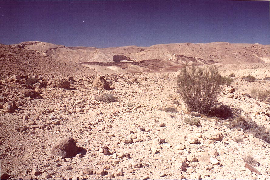 Open parts of Nahal Darokh river on Zin valley, with the horseshoe formation on the background, 4 miles east from Sde Boker. The Middle East, April 9, 2001  Caves at Nahal Darokh river 4.5 miles east from Sde Boker. The Middle East, April 9, 2001  View from caves at Nahal Darokh river 4.5 miles east from Sde Boker. The Middle East, April 9, 2001  Caves with traces of a dried spring on the left, at Nahal Darokh river 4.5 miles east from Sde Boker. The Middle East, April 9, 2001  Fresnel-shaped patterns on yellow limestone at the bottom of small caves of Nahal Darokh river 4.5 miles east from Sde Boker. The Middle East, April 9, 2001  Upper Nahal Darokh river 5 miles east from Sde Boker. The Middle East, April 9, 2001  Upper Nahal Darokh river 5 miles east from Sde Boker. The Middle East, April 9, 2001  Upper Nahal Darokh river 5 miles east from Sde Boker. The Middle East, April 9, 2001  Upper Nahal Darokh river 5 miles east from Sde Boker. The Middle East, April 9, 2001  Dried stream going to upper Nahal Darokh river 5 miles east from Sde Boker. The Middle East, April 9, 2001  Nahal Darokh river 4.5 miles east from Sde Boker. The Middle East, April 9, 2001  Nahal Darokh river 4.5 miles east from Sde Boker. The Middle East, April 9, 2001  A hill near a waterfall of Nahal Darokh river 4.5 miles east from Sde Boker. The Middle East, April 9, 2001  Chalk hills at Nahal Darokh river 4 miles east from Sde Boker. The Middle East, April 9, 2001  Chalk hills at Nahal Darokh river 4 miles east from Sde Boker. The Middle East, April 9, 2001  Chalk hills at Nahal Darokh river 4 miles east from Sde Boker. The Middle East, April 9, 2001  Steep parts of Nahal Darokh river 4.5 miles east from Sde Boker. The Middle East, April 9, 2001  View of a big pool behind the second fall of Nahal Darokh river 4 miles east from Sde Boker. The Middle East, April 9, 2001  A waterfall and a trail bypassing it on Nahal Darokh river 4.5 miles east from Sde Boker. The Middle East, April 9, 2001  Open parts of Nahal Darokh river on Zin valley 4 miles east from Sde Boker. The Middle East, April 9, 2001  A big pool with mosquito larvae behind the second fall of Nahal Darokh river 4 miles east from Sde Boker. The Middle East, April 9, 2001  Thorny plants near a small pool of Nahal Darokh river 4.5 miles east from Sde Boker. The Middle East, April 9, 2001  Gnawed skull of a small animal in a cave at Nahal Darokh river 4.5 miles east from Sde Boker. The Middle East, April 9, 2001  Mysterious black stones collected on a terrace near Nahal Darokh river 4.5 miles east from Sde Boker. The Middle East, April 9, 2001  Tributary of Nahal Darokh river going through chalk hills 4 miles east from Sde Boker, view from lower site. The Middle East, April 9, 2001  A ridge in Hatira Mountains 4 miles east from Sde Boker, near the upper Nahal Hatsats river. The Middle East, April 9, 2001  Blackened brain-like stones in limestone in Hatira Mountains 4.5 miles east from Sde Boker, near the upper Nahal Hatsats river. The Middle East, April 9, 2001  Nahal Nekarot River (?) at southern side of Ramon Crater, 6 miles south-east from Mitzpe Ramon. The Middle East, May 3, 2001  One of tributaries of Nahal Nekarot River at southern side of Ramon Crater, 6 miles south-east from Mitzpe Ramon. The Middle East, May 3, 2001  Landscape near Nahal Nekarot River at southern side of Ramon Crater, 6 miles south-east from Mitzpe Ramon. The Middle East, May 3, 2001  One of tributaries of Nahal Nekarot River at southern side of Ramon Crater, 6 miles south-east from Mitzpe Ramon. The Middle East, May 3, 2001  One of tributaries of Nahal Nekarot River at southern side of Ramon Crater, 6 miles south-east from Mitzpe Ramon. The Middle East, May 3, 2001  A tributary of Nahal Nekarot River running from southern side of Ramon Crater, 6 miles south-east from Mitzpe Ramon. The Middle East, May 3, 2001  Desert plants near Nahal Nekarot River at southern side of Ramon Crater, 6 miles south-east from Mitzpe Ramon. The Middle East, May 3, 2001  View to the west along Nahal Nekarot River at southern side of Ramon Crater, 6 miles south-east from Mitzpe Ramon. The Middle East, May 3, 2001  Nahal Sekhvee River north from Safed, landscape of a wadi in Upper Galilee. The Middle East, April 19, 2001  A big tributary of Nahal Nekarot River and Ramon s Tooth (black hill) at southern side of Ramon Crater, 6 miles south-east from Mitzpe Ramon. The Middle East, May 3, 2001  Crossing Nahal Divshon creek, 1.5 miles south from Ben Gurion College at Sde Boker. The Middle East, February 15, 2001  A plant in a riverbed in Zin valley, 3 miles east from Sde Boker. The Middle East, April 9, 2001  Negev Desert 2.5 miles north-east from Sde Boker at morning. The Middle East, April 9, 2001  Nahal Peres River 2 miles north from Tamar ascent to Dead Sea (Road 25), 15 miles east from Dimona. The Middle East, May 10, 2001  View of Qeren Akev Mt. behind Zin valley from Ma ale Zin Road, 2 miles south-east from Sde Boker. The Middle East, April 9, 2001  Going down and approaching a road from Ein Avdat Reserve, with Nahal Horim creek hills behind it, 1 miles south from Ben Gurion College at Sde Boker. The Middle East, February 15, 2001  View of the Negev Desert to the west along Nahal Nekarot River, 6 miles south-east from Mitzpe Ramon. The Middle East, May 3, 2001  Descent to Dead Sea along Nahal Peres River in the plateau near Har Tsurim, 2 miles north from Tamar ascent to Dead Sea (Road 25), 15 miles east from Dimona. The Middle East, May 10, 2001  Nahal Peres River 2 miles north from Tamar ascent to Dead Sea (Road 25), 15 miles east from Dimona, 100 m south from a hill and a jeep road (there is a deep canyon to the right). The Middle East, May 10, 2001  Bones inside one of columbarium caves in Bet Atab village, 4 miles east from Beit Shemesh. The Middle East, July 5, 2001  Upper part of Nahal Shani river, 9 miles north from Eilat. The Middle East, February 7, 2002  Ancient columbarium caves (?) in an abandoned Arab village of Bet Atab, 4 miles east from Beit Shemesh. The Middle East, July 5, 2001  Ancient donkey path from Safed to the mills of Nahal Ammud along Nahal Sekhvee River. The Middle East, April 19, 2001  Valley of Nahal Bokek River in Judean Desert, 3 miles west from Ein Bokek. The Middle East, April 17, 2001  Nahal Bokek River in Judean Desert, on a plateau 2 miles west from Ein Bokek. The Middle East, April 17, 2001  Valley of Nahal Bokek River in Judean Desert, 3 miles west from Ein Bokek. The Middle East, April 17, 2001  Desert plateau 2 miles south-east from Ben Gurion College at Sde Boker. The Middle East, February 15, 2001  Upper fragment of a sandstone formation in Timna Mountains. The Middle East, March 15, 2001  Shallow parts of Nahal Bokek River in Judean Desert, 3 miles west from Ein Bokek. The Middle East, April 17, 2001  Shallow parts of Nahal Bokek River in Judean Desert, 3 miles west from Ein Bokek. The Middle East, April 17, 2001  Nahal Tseelim River, 2 miles north from Masada. The Middle East, January 20, 2001  Descent to Dead Sea along Nahal Peres River, 2 miles north from Tamar ascent to Dead Sea (Road 25), 15 miles east from Dimona, 300 m south from a jeep road. The Middle East, May 10, 2001  Descent to Dead Sea along Nahal Peres River, 2 miles north from Tamar ascent to Dead Sea (Road 25), 15 miles east from Dimona, 500 m south from a jeep road. The Middle East, May 10, 2001  Descent to Dead Sea along Nahal Peres River, 2 miles north from Tamar ascent to Dead Sea (Road 25), 15 miles east from Dimona, 400 m south from a jeep road. The Middle East, May 10, 2001  Descent to Dead Sea along Nahal Peres River, 2 miles north from Tamar ascent to Dead Sea (Road 25), 15 miles east from Dimona, 250 m south from a hill and a jeep road. The Middle East, May 10, 2001  Descent to Dead Sea along Nahal Peres River and a jeep road in the area of Har Tsurim, 2 miles north from Tamar ascent to Dead Sea (Road 25), 15 miles east from Dimona. The Middle East, May 10, 2001  Descent to Dead Sea along Nahal Peres River and a jeep road in the area of Har Tsurim, 2 miles north from Tamar ascent to Dead Sea (Road 25), 15 miles east from Dimona. The Middle East, May 10, 2001  Descent to Dead Sea along Nahal Peres River and a jeep road in the area of Har Tsurim, 2 miles north from Tamar ascent to Dead Sea (Road 25), 15 miles east from Dimona. The Middle East, May 10, 2001  Descent to Dead Sea along Nahal Peres River and a jeep road in the plateau near Har Tsurim, 2 miles north from Tamar ascent to Dead Sea (Road 25), 15 miles east from Dimona. The Middle East, May 10, 2001  Descent to Dead Sea along Nahal Peres River, 2 miles north from Tamar ascent to Dead Sea (Road 25), 15 miles east from Dimona, 200 m south from a hill and a jeep road. The Middle East, May 10, 2001  Shallow parts of Nahal Bokek River in Judean Desert, on a plateau 2 miles west from Ein Bokek. The Middle East, April 17, 2001  Upper pools of Nahal Arugot river in Ein Gedi park. The Middle East, April 4, 2002  Upper pools of Nahal Arugot river in Ein Gedi park. The Middle East, April 4, 2002  Limestone along Nahal Tseelim River, 2 miles north from Masada. The Middle East, January 20, 2001  Nahal Tseelim River Canyon, 2 miles north from Masada. The Middle East, January 20, 2001  Nahal Tseelim River and Dead Sea, 2 miles north from Masada. The Middle East, January 20, 2001  Nahal Bokek River in Judean Desert, view from Tsuk Tamrur hill, 3 miles west from Ein Bokek. The Middle East, April 17, 2001  Mountains on northern side of Nahal Tseelim Canyon, 2 miles north from Masada. The Middle East, January 20, 2001  Mountains on northern side of Nahal Tseelim Canyon, 2 miles north from Masada. The Middle East, January 20, 2001  Mountains on northern side of Nahal Tseelim Canyon, 2 miles north from Masada. The Middle East, January 20, 2001  Springs of upper pools of Nahal Arugot river in Ein Gedi park. The Middle East, April 4, 2002  Starting a trip along Nahal Tseelim River, 2 miles north from Masada. The Middle East, January 20, 2001  Entrance to Nahal Tseelim River Gorge, 2 miles north from Masada. The Middle East, January 20, 2001  Upper part of Nahal Yamin canyon, 8 miles south-east from Yeroham. The Middle East, March 2, 2002  Descent to Dead Sea along Nahal Peres River and a jeep road in the plateau near Har Tsurim, 2 miles north from Tamar ascent to Dead Sea (Road 25), 15 miles east from Dimona, view to the south to the direction of Dead Sea. The Middle East, May 10, 2001  Upper Nahal Mapalim creek north from Mount Shelomo, 3 miles north-west from Eilat. The Middle East, March 22, 2001  Mills (?) at Nahal Ammud River near Safed. The Middle East, April 19, 2001  Descent to Dead Sea along Nahal Peres River and a jeep road in the plateau near Har Tsurim, 2 miles north from Tamar ascent to Dead Sea (Road 25), 15 miles east from Dimona, view to the north with Har Hamarma (?) at the horizon. The Middle East, May 10, 2001  Beginning of the lower Nahal Peres Canyon 1 mile north-east from Tamar ascent to Dead Sea (Road 25), 17 miles east from Dimona, view to the west. The Middle East, May 10, 2001  Canyon of Nahal Sekhvee River north from Safed. The Middle East, April 19, 2001  A mill near Ein Po em spring at Nahal Ammud River near Safed. The Middle East, April 19, 2001  Ancient trail along Nahal Sekhvee River near Safed. The Middle East, April 19, 2001  Nahal Ammo river in Galilee, view from Road 85. The Middle East, April 7, 2001  Ancient trail along Nahal Sekhvee River near Safed. The Middle East, April 19, 2001  Nahal Besor River with Urim airfield at the background in Eshkol Park 10 miles west from Ofakim. The Middle East, February 27, 2001 |